Pinar del Rio
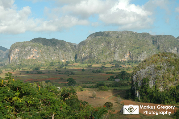
The Pinar del Río province contains one of Cuba's three main mountain ranges, the Cordillera de Guaniguanico, divided into the easterly Sierra del Rosario and the westerly Sierra de los Organos. These form a landscape characterised by steep sided limestone hills (called mogotes) and flat, fertile valleys. Such a topographic feature, the Viñales Valley, is a UNESCO World Heritage Site.The northern coast opens to the great Gulf of Mexico, and is lined by the Colorados Archipelago, a string of cays and isles developed on a reef barrier. The western most point of Cuba, Cabo San Antonio is located on the Guanahacabibes Peninsula, which is a National Park and a Biosphere Reserve.